-
About
-
Product
-
Solution
-
Support
-
News
-
Join
About
Product
Solution
Support
News
Join


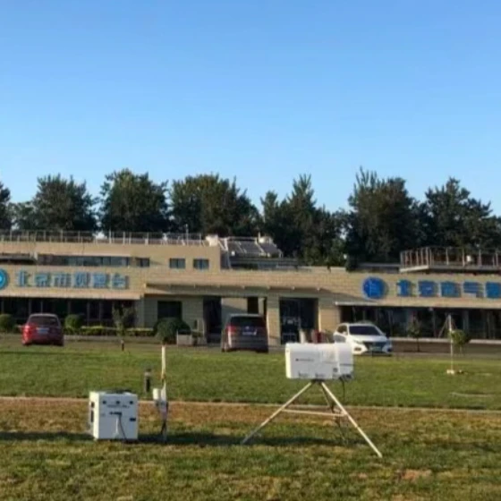
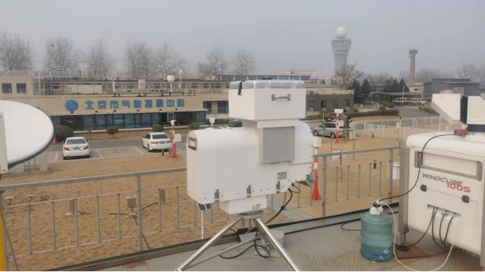
The ground-based microwave radiometer joint observation system is composed of a ground-based microwave radiometer and a Doppler wind profiler lidar. Among them, the ground-based microwave radiometer has the ability to receive temperature and water vapor multi-channel composite atmospheric microwave radiation, and automatically detects various atmospheric parameters such as atmospheric temperature, humidity, vertical distribution of cloud water, water vapor and liquid water content within 10km of the headspace in real time. It can monitor the temperature, humidity, air pressure, precipitation and other meteorological elements and equipment working status information at the work site, and use the full Chinese, graphical integrated processing terminal to record, display and playback in real time. Doppler wind profiler lidar is a kind of remote sensing equipment for high-altitude wind field detection by emitting electromagnetic beams in different directions to the high altitude, receiving and processing the information returned by these electromagnetic beams due to the uneven vertical structure of the atmosphere. Wind profiler radar can detect the change of meteorological elements such as wind direction and wind speed with altitude by using the Doppler effect. It has the advantages of high spatial and temporal resolution and high degree of automation.

High stability

Detection range

easy to use

Strong scalability

Artificial weather modification: Using radiometer to monitor cloud layer data provides important reference for the monitoring, catalysis and inspection process of artificial rainfall.
Regional air water resource assessment: Use the radiometer atmospheric humidity detection data to invert the water vapor content in the regional atmospheric stratification to evaluate the air water resource.
Real-time high-precision monitoring of airborne meteorological elements: monitoring atmospheric integral water vapor, temperature, and humidity profiles, liquid water content in clouds, and cloud heights, combined with other equipment to monitor wind, lightning, aerosols, and gas molecules.
Short-term weather forecast: Combine the air moisture and temperature detection data to carry out regional short-term weather forecast.
Disaster weather warning in key areas: Cloud water ice data detection is carried out for airports and air routes to ensure flight safety.
Three-dimensional monitoring and early warning of smog: Based on a variety of data analysis, regional pollution process, regional pollution characteristics, and regional pollution sources, do a good job of current situation assessment, and provide decision-making basis.
Marine environment monitoring: Through the detection of the specific emissivity of the ocean surface radiation, it can remotely sense the marine environment such as ocean salinity, marine infield, and red tide at medium and small scales.

 WeChat
 T1-11F, Herui Science and Technology Park, Binjiang District, Hangzhou City, Zhejiang Province