

-
About
-
Product
-
Solution
-
Support
-
News
-
Join
About
Product
Solution
Support
News
Join

 PubDate:2025-12-30
 ViewNum:549

Highlighted by CCTV: Deciphering the Weather Code Behind Cold Advection Snow

In winter, Yantai and Weihai on the Shandong Peninsula are frequently hit by exceptionally heavy snowfalls. This is not ordinary inland snow, but a weather phenomenon known as cold advection snow. Originating from the fierce clash between marine air and cold air masses, it erupts under specific geographical conditions, often transforming the cities into snow nests overnight.
Then, what exactly is cold advection snow? Why does it always favor Yantai and Weihai? What intense weather processes lie behind it?
Cold advection snow is also known as sea-effect snow. In winter, the relatively warm sea surface acts like a giant humidifier and radiator, continuously transferring water vapor and heat into the air. When the cold air mass moving southward from the north meets this warm and moist air, the water vapor cools down, condenses into ice crystals, and thus forms snowfall. As the airflow moves further inland, it is more likely to converge and lift upward under the influence of orographic lifting and other factors, thereby intensifying the snowfall.
The Cold Advection Snow Observation Experiment in Eastern China focuses on the formation mechanism of cold advection snow. By comprehensively adopting observation methods such as atmospheric physics and atmospheric chemistry, it conducts multi-scale observations ranging from the macroscopic characteristics of storms to the microscopic structures of snowflakes, aiming to systematically reveal the key physical processes of cold advection snowstorms.
Zhang Yun, chief scientist of the Cold Advection Snow Observation Experiment in Eastern China, stated: "We need to not only conduct ground-based and space-based in-situ observations of the physical characteristics of snowflakes, such as their shape, size, quantity and density, but also adopt methods including radar remote sensing and numerical models to study the physical processes involved in snowstorm formation."
The experimental team focused on two core scientific questions: first, where the small ice crystals in cold advection clouds originate; second, how these small ice crystals grow rapidly to form cold advection snowstorms. To better figure out these answers, on the basis of conventional meteorological observations, the team added a series of new domestic automated observation instruments, including an ultra-high-resolution triple-frequency radar, a snowflake microphysics analyzer, a five-view multi-angle imager, and an automatic snowfall collector. This has enabled snowflake observations to leap from traditional manual visual inspection to automation and high precision. Since the launch of the experiment, hundreds of thousands of pieces of data on snowflakes of diverse morphologies have been recorded.
This year, the team also conducted the first attempt to apply unmanned aerial vehicle (UAV) and pilot balloon sounding technologies to detect airborne snow particles and atmospheric temperature and humidity profiles, thus preliminarily obtaining the key environmental information about snowflake growth in the air.
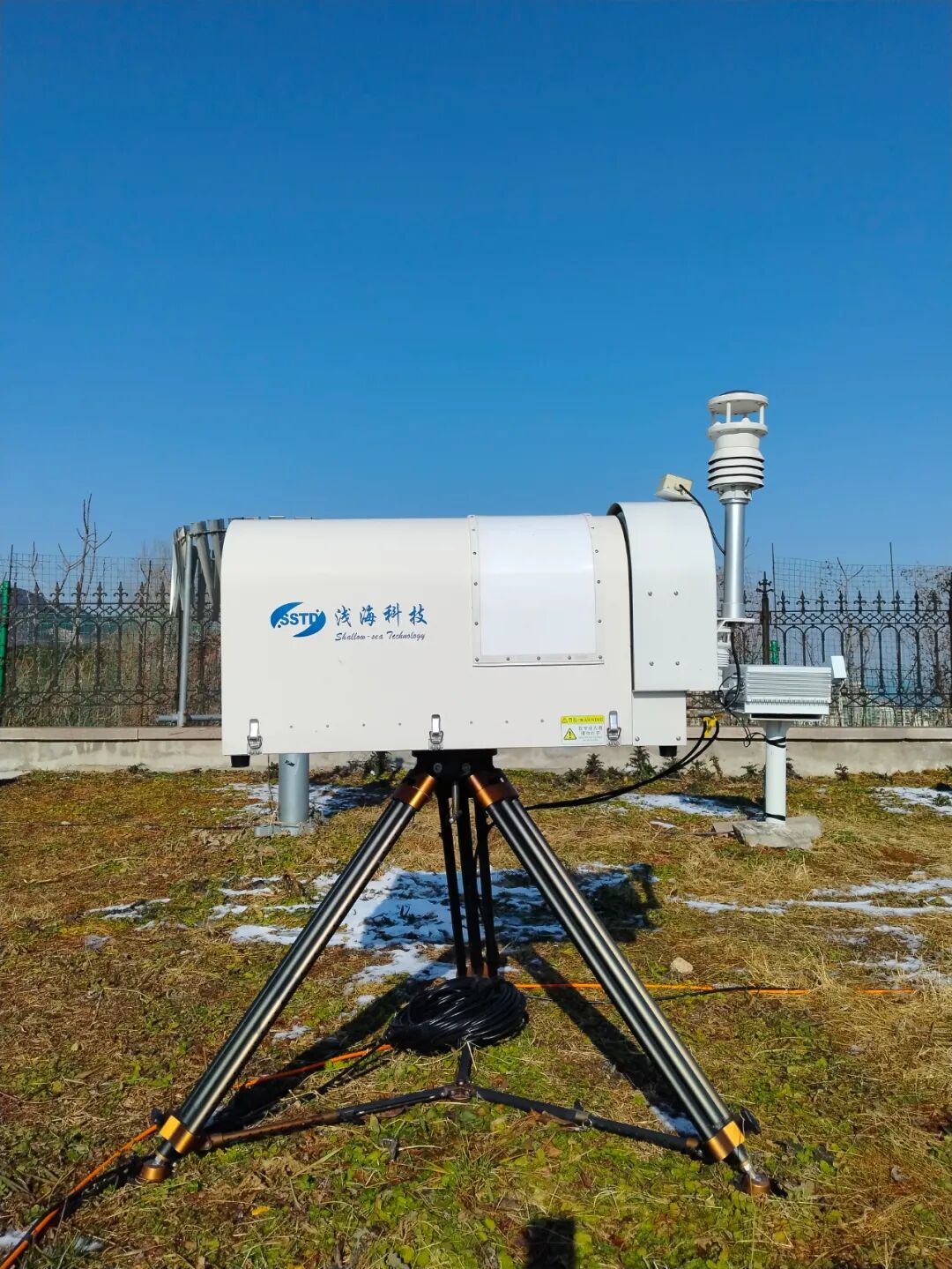
2D Video Disdrometer (SVD-2): The "HD Microscope" for Snowflakes
It can capture real-time 2D images of every single snowflake, accurately analyze its size, shape and falling velocity, automatically identify different snowflake morphologies via AI algorithms, and record the complete evolutionary process of snowflakes from formation to landing.
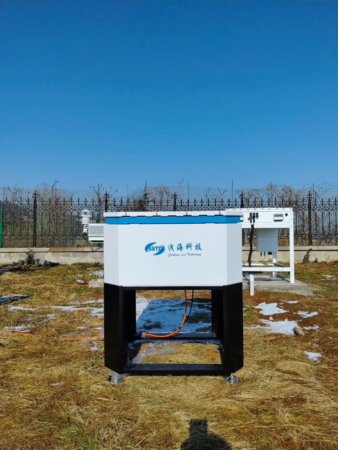
Microwave Radiometer (SMR-100): The "CT Scanner" of the Atmosphere
It can continuously monitor the temperature and humidity profiles from the ground up to an altitude of 10 kilometers, accurately measure the water vapor content and liquid water path in the atmosphere, update data in real time, and capture the rapid changes in atmospheric conditions.
Coordinated Operation: A New Breakthrough with 1+1>2 Synergy
In this observation campaign, the collaborative operation of multiple instruments has generated first-hand meteorological data for the experiment.
Formation of a 3D Monitoring Network: The Microwave Radiometer reveals the vertical structure of atmospheric temperature and humidity, while the 2D Video Disdrometer analyzes precipitation particles from a microscopic perspective. The combination of the two constructs a complete 3D picture of atmospheric precipitation.
The triggering mechanism of cold advection snow has been clearly identified: the Microwave Radiometer detects a sudden increase in humidity and temperature at specific altitude layers, and the 2D Video Disdrometer subsequently captures the formation of snowflakes, thus defining the precise atmospheric conditions for the triggering of cold advection snow.
Future Outlook: A New Chapter of Smart Meteorology
From the marvelous "snow nest" spectacle that astounded the ancients to the meteorological phenomenon gradually deciphered by technology today, the evolution from single-instrument observation to collaborative innovation of multiple instruments is not only a microcosm of the development of meteorological science and technology in China, but also a vivid embodiment of scientific and technological innovation serving social wellbeing and people's livelihoods. Those once-mysterious natural phenomena are gradually becoming predictable and interpretable.
 Next:Shining on the Coast of the South China Sea! Qinhai Technology Brings Its Star Products to the Academic Event on Tropical Marine Meteorology


 WeChat
 T1-11F, Herui Science and Technology Park, Binjiang District, Hangzhou City, Zhejiang Province


